
Odsek za sisteme in vodenje
Inštitut Jožef Stefan


1.9.2006 - 31.9.2009
Projekt 6. okvirnega programa EU, številka pogodbe AST5-CT-2006-030839
Approaches, landings and take-offs, or more generally, manoeuvres or navigation in the terminal
zone, are among the most critical tasks in aircraft operation.
Today, the only certified navigation system available for landings,
ground rolls and take-offs are the ILS and MLS which require heavy
airport infrastructures; recently, one can notice a trend towards the
GNSS systems (Global Navigation Satellite Systems) which have not the
necessary integrity. This clearly highlights the unmet need for new systems
which could either replace or complement existing systems.
PEGASE is a feasibility study of a new Navigation System which allows
a three dimensional truly autonomous approach and guidance for airports
and helipads and improves the integrity and accuracy of GNSS differential
navigation systems. This new Navigation System relies on three key technologies:
 The ambitions of the PEGASE project are twofold.
Firstly, it will pave the way for a new all weather autonomous
standard Navigation System by validating the technologies necessary
to achieve a cost effective navigation means that has higher accuracy
and integrity than existing ones (typically ILS/MLS), yet is not susceptible to jamming.
Secondly, it will contribute to demonstrating that such a new Navigation
System can help reduce noise levels and fuel consumption through new procedures
in the terminal zone and address flow delays in adverse weather conditions.
In this way, PEGASE contributes to the enhancement of the future 2012 Air Traffic Management.
The ambitions of the PEGASE project are twofold.
Firstly, it will pave the way for a new all weather autonomous
standard Navigation System by validating the technologies necessary
to achieve a cost effective navigation means that has higher accuracy
and integrity than existing ones (typically ILS/MLS), yet is not susceptible to jamming.
Secondly, it will contribute to demonstrating that such a new Navigation
System can help reduce noise levels and fuel consumption through new procedures
in the terminal zone and address flow delays in adverse weather conditions.
In this way, PEGASE contributes to the enhancement of the future 2012 Air Traffic Management.
The main objectives of the study are:
The expected results of the study will include:
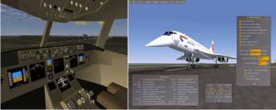
The study will be carried out with existing simulation tools and Man Machine Interface
(MMI) developed for fixed wing and rotary wing aircraft. It is not intended to study in
this project dedicated MMI since no specific need has been identified. Coupling to systems
such as Synthetic Vision System could be addressed in a further development stage.
Spletna stran projekta: http://dassault.ddo.net/pegase/
Domov |
Novice |
Kontakt |
Jezik |
Prijava
Predstavitev |
Ljudje |
R&R teme |
Projekti |
Izobraževanje |
Objave |
Aplikacije |
Partnerji |
Prosta mesta
Copyright © 2007-2026 IJS Vse pravice pridržane.